Gravelly Shoal Light
From lighthouses
| Line 1: | Line 1: | ||
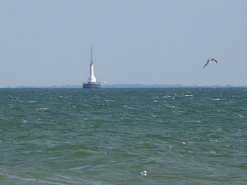
[[Image:Gravelly Shoal Light.jpg|thumb|350px|''Gravelly Shoal Light'' in 2010 – 52nd trip]] | [[Image:Gravelly Shoal Light.jpg|thumb|350px|''Gravelly Shoal Light'' in 2010 – 52nd trip]] | ||
| - | |||
Au Gres, Michigan | Au Gres, Michigan | ||
| Line 8: | Line 7: | ||
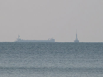
This 65 foot tall, steel sided “Art Deco” style lighthouse sits on a 50 foot diameter concrete pier and has a focal plane of 75 feet. This active light sits 2.7 miles offshore on the shallow shoals extending southeast from Point Lookout on the western side of Saginaw Bay in Lake Huron. Built as part of President Roosevelt’s New Deal, it replaced the deactivated Charity Island Light to help guide vessels through the deeper water between Gravelly Shoal and Big Charity Island. The steel tower atop the light is a radio beacon. <br clear=all> | This 65 foot tall, steel sided “Art Deco” style lighthouse sits on a 50 foot diameter concrete pier and has a focal plane of 75 feet. This active light sits 2.7 miles offshore on the shallow shoals extending southeast from Point Lookout on the western side of Saginaw Bay in Lake Huron. Built as part of President Roosevelt’s New Deal, it replaced the deactivated Charity Island Light to help guide vessels through the deeper water between Gravelly Shoal and Big Charity Island. The steel tower atop the light is a radio beacon. <br clear=all> | ||
| + | [[Image:Gravelly Shoal Light1.jpg|thumb|350px|''Gravelly Shoal Light'' in 2010 – 52nd trip]] | ||
---- | ---- | ||
Navigational Options | Navigational Options | ||
Current revision
Au Gres, Michigan
Built: 1939
Automated: 1939
This 65 foot tall, steel sided “Art Deco” style lighthouse sits on a 50 foot diameter concrete pier and has a focal plane of 75 feet. This active light sits 2.7 miles offshore on the shallow shoals extending southeast from Point Lookout on the western side of Saginaw Bay in Lake Huron. Built as part of President Roosevelt’s New Deal, it replaced the deactivated Charity Island Light to help guide vessels through the deeper water between Gravelly Shoal and Big Charity Island. The steel tower atop the light is a radio beacon.
Navigational Options
- Return to Fifty-second Lighthouse Expedition
- Go to Alphabetical Listing
- Go to Geographical Listing
- Return to Lighthouse Home Page
Lighthouses: A Photographic Journey
- Conceived and Developed by David S. Carter
- Photographs by Donald W. Carter
- Text by Diana K. Carter, Donald W. Carter & David S. Carter
Copyright © 1995-2011 David S. Carter, Donald W. Carter, & Diana K. Carter. All rights reserved. Reproduction by any means, physical or electronic, in part or in full, without the express permission of the authors, is strictly prohibited.
This article was last modified on 9/5/2010.


