Point Iroquois Light
From lighthouses
| Line 1: | Line 1: | ||
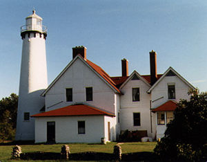
[[Image:Point Iroquois Light.jpg|thumb|300px|''Point Iroquois Light'' in 1987 - 2nd trip]] | [[Image:Point Iroquois Light.jpg|thumb|300px|''Point Iroquois Light'' in 1987 - 2nd trip]] | ||
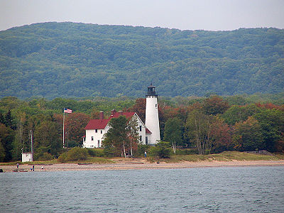
| - | [[Image:Point Iroquois Light1.jpg|thumb| | + | [[Image:Point Iroquois Light1.jpg|thumb|400px|''Point Iroquois Light'' in 2007 - 48th trip]] |
Brimley, Michigan | Brimley, Michigan | ||
Revision as of 17:09, 26 January 2010
Brimley, Michigan
Built: 1871
Decommissioned: 1962
The Point Iroquois Light sits silently at the entrance to the St. Mary's River and the Soo Locks, one of the busiest shipping lanes in the world. The present brick structure, which replaced a previous wooden structure, was itself replaced by a beacon which sits further out in the water. The lighthouse and its property are now under the control of the United States Forest Service.
Navigational Options
- Return to Second Lighthouse Expedition
- Return to Forty-eighth Lighthouse Expedition
- Go to Alphabetical Listing
- Go to Geographical Listing
- Return to Lighthouse Home Page
Lighthouses: A Photographic Journey
- Conceived and Developed by David S. Carter
- Photographs by Donald W. Carter
- Text by Diana K. Carter, Donald W. Carter & David S. Carter
Copyright © 1995-2011 David S. Carter, Donald W. Carter, & Diana K. Carter. All rights reserved. Reproduction by any means, physical or electronic, in part or in full, without the express permission of the authors, is strictly prohibited.
This article was last modified on 1/26/2010.


