Policies Affecting Siting
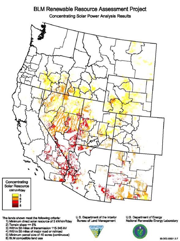
Besides economic drivers for utility-scale solar development there are state and federal policies that incentivize the use of public lands for renewable energy generation. In 2003 the US Department of the Interior (DOI) and the DOE released "Assessing the Potential for Renewable Energy on Public Lands." This report identified areas with the best solar energy potential in terms of sun, slope, transmission access, road availability, size, and are located where federal, state, and local policies are supportive.1 This information generated a map identifying areas with the best potential for solar energy development, most of which are concentrated in southern California and portions of Nevada and Arizona (Map 1).
Both the DOI/DOE report and the California RPS encouraged solar developers to study public lands in Southern California for utility-scale development. Knowledge of the primary policy drivers of utility- scale solar development on public lands is necessary to understand the current situation in the California desert.
1 Department of the Interior and Department of Energy. 2003. Assessing the Potential for Renewable Energy on Public Lands. Retrieved 26 May 2009. <http://www.nrel.gov/docs/fy03osti/33530.pdf>

